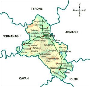
County Monaghan
County Monaghan is one of three Ulster counties within the boundaries of the Republic of Ireland, the others being Donegal and Cavan. It is known simply as 'Drumlin country', mainly because of all the little hills spread throughout the county. Monaghan was in the theatre of the Irish Troubles, as it shares its northern border with Fermanagh, Tyrone and Armagh.
History
Monaghan was once a part of the Ulster territory, the Kingdom of Oriel. The dominant families of the region - the Mc Mahons, the McKennas and O'Connollys practically ruled the area until the English administration reformed the regions in the 16th century.
After the defeat of the rebellion of Eoin O'Neill and the Ulster chieftains in 1603, the county was not planted like the other counties of Ulster. The lands were instead left in the hands of the native chieftains. In 1641 the McMahons and their allies joined the general rebellion of Irish Catholics, and following their defeat there was some plantation of the county with Scottish and English families.
