Lake Albert
Lake Albert is one of the African Great Lakes and is located on the border between Uganda and the Democratic Republic of the Congo. It is Africa's seventh-largest lake, as well as the second biggest of Uganda's Great Lakes. The lake was originally known as Lake Mwitanzige by the Banyoro, Nam Ovoyo Bonyo by the Alur, and temporarily as Lake Mobutu Sese Seko.
Lake Albert is the northernmost of the chain of lakes in the Albertine Rift, the western branch of the East African Rift.
It is about 160 km long and 30 across at its widest, with a maximum depth of 51 m and a surface elevation of 619 m above sea level.
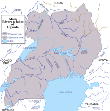
Lake Albert is part of the complicated system of the upper Nile. Its main sources are the White Nile, ultimately coming from Lake Victoria to the southeast, and the Semliki River, which issues from Lake Edward to the southwest. The water of the Victoria Nile is much less saline than that of Lake Albert. The lake's outlet, at its northernmost tip, is the Albert Nile section of the White Nile. The river later becomes known as the Mountain Nile when its course enters South Sudan.
At the southern end of the lake, where the Semliki comes in, there are swamps. The Rwenzori Mountains are to the south of the lake and to the northwest, the Blue Mountains. The few settlements along the shore include Butiaba and Pakwach.
Attribution
- Some content on this page may previously have appeared on Wikipedia.
Footnotes
