File:Indian Territory Map 1879.jpg
Jump to navigation
Jump to search
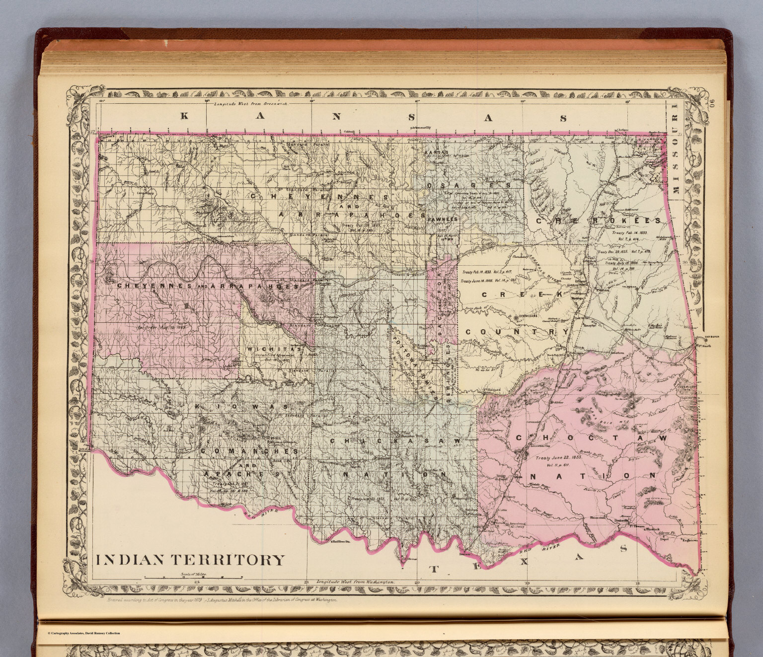
Size of this preview: 696 × 599 pixels. Other resolution: 1,536 × 1,323 pixels.
Original file (1,536 × 1,323 pixels, file size: 739 KB, MIME type: image/jpeg)
File history
Click on a date/time to view the file as it appeared at that time.
| Date/Time | Thumbnail | Dimensions | User | Comment | |
|---|---|---|---|---|---|
| current | 19:52, 11 March 2022 | | 1,536 × 1,323 (739 KB) | Maintenance script (talk | contribs) | == Summary == Importing file |
You cannot overwrite this file.
File usage
The following 2 pages use this file: