Loch Lomond & The Trossachs National Park
The 'Loch Lomond and the Trossachs National Park in Scotland opened in July 2002. The Park embraces diverse landscapes from the high country of Breadalbane to the sea lochs of Argyll. The Highland Boundary Fault cuts through the Park, dividing the Lowlands from the rugged terrain of the Highlands.
Overview
The Park is divided into the four distinct areas of Lomond, Argyll, The Trossachs and Breadalbane and it covers approximately 1,865 sq km (720 sq miles) and has a boundary length of 350km (220miles). Within the 350km (220miles) boundary of the park are twenty Munro's, twenty Corbett's and twenty large lochs.
The park is bisected by the West Highland Way, Scotlands first long distance footpath. It starts in the outskirts of Glasgow, and passes through the heart of the National Park, passing into Rannoch Moor and finishing at the top of Ben Nevis.
The park was established under the National Parks (Scotland) Act 2000 that sets out four National Park aims:
- To conserve and enhance the natural and cultural heritage of the area,
- To promote sustainable use of natural resources of the area,
- To promote understanding and enjoyment (including enjoyment in the form of recreation) of the special qualities of the area by the public
- To promote sustainable economic and social development of the area's communities.
There are over 15,000 people living in the park and these aims are to be pursued by all public bodies with an interest in the area, and the National Park Authority's purpose is to ensure that they are achieved in a co-ordinated way.
Lomond
This area, which surrounds Loch Lomond, the largest expanse of freshwater in Scotland, includes Balloch, Rowardennan, Balmaha, Luss, Tarbet and Ardlui. Ben Lomond is on the east side of Loch Lomond. In the north, the loch is deep and narrow, and is bounded by steep-sided mountains.
Loch Lomond is immortalised in a well-known traditional Scottish song, first published in 1841.
- By yon bonnie banks and by yon bonnie braes
- Where the sun shines bright on Loch Lomond
- Where me and my true love will ne-er meet again
- On the bonnie, bonnie banks o’ Loch Lomond.
- Chorus:
- O you’ll tak’ the high road and I’ll tak’ the low road
- And I’ll be in Scotland afore ye
- For me and my true love will ne-er meet again
- On the bonnie, bonnie banks o’ Loch Lomond.
Argyll
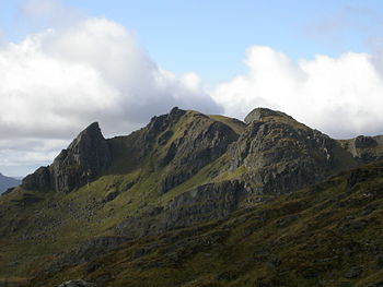
The western area of the Park includes Helensburgh, Strachur, Arrochar and the Argyll forest park. Three sealochs penetrate this area, and the 'Arrochar Alps' border the Argyll Forest to the south. One mountain overlooking Loch Long is Ben Arthur, commonly know as The Cobbler since one of its three peaks resembles the figure of a 'crooked shoe maker'. It is relatively small and often ignored by the "Munro-Baggers" due to its status as a Corbett,[1] yet, it is one of the most dramatic hikes in Scotland, culminating in an intricate move through a gap onto a ledge, known as threading the needle, to reach the central summit.
The Trossachs
This central area includes Aberfoyle, Loch Katrine pier, Brig o' Turk, Callander & Strathyre. It also includes the Queen Elizabeth Forest Park, seven major lochs and many small lochs. The area was the haunt of Rob Roy MacGregor. Loch Katrine is well known for 100 year old pleasure Steamer "Sir Walter Scott".
The "MacGregor Monument" is on the 'Lanrick Estate', on the south bank of the River Teith between Doune and Callander. It resembles the trunk of a large oak - the tree emblem which is part of the Arms of the Chiefs of Clan Gregor.
- Heaven gave Rob Roy a dauntless heart,
- And wondrous length and strength of era,
- Nor craved he more to quell his foes,
- Or keep his friends from harm.
- Yet was Rob Roy as wise as brave
- Forgive me if the phrase he strong
- A poet worthy of Rob Roy
- Must scorn a timid song.
- Bear witness many a pensive sigh
- Of thoughtful herdsman when he strays
- Alone upon Loch Veol’s heights,
- And by Loch Lomond’s braes
- (William WorsworthMemorials of a tour in Scotland, 1803, X. Rob Roy's grave)
Breadalbane
This northern area including Glen Dochart, Killin and Glenogle (St Fillans and Loch Tay are excluded). This part of Highland Scotland was once owned by the notorious Campbell family and 'Black Duncan Campbell', who built Edinample Castle by Loch Earn in the 16th century. Another of his castles was Finlarig Castle at Killin, built in 1629. According to legend, a pit there was where nobles were executed, while commoners were hanged on a nearby oak tree. Four well known Munroes lie in this area: Ben Lui, Ben Challum, Ben More and Ben Vorlich. Loch Dochart Castle, built by Black Duncan between Killin and Crianlarich, was destroyed by the MacNabs in 1646. 'Black' Duncan's grandson, Sir John Campbell of Glenorchy, who was created 1st Earl of Breadalbane in 1681, was strongly implicated in the Massacre of Glencoe.
References
- ↑ Corbett's are Scottish mountains between 2,500 ft and 3,000 ft. Munroe's are Scottish mountains higher than 3,000 ft
