File:Map north america 1755 1760.jpg
Jump to navigation
Jump to search
Size of this preview: 800 × 526 pixels. Other resolution: 1,024 × 673 pixels.
Original file (1,024 × 673 pixels, file size: 276 KB, MIME type: image/jpeg)
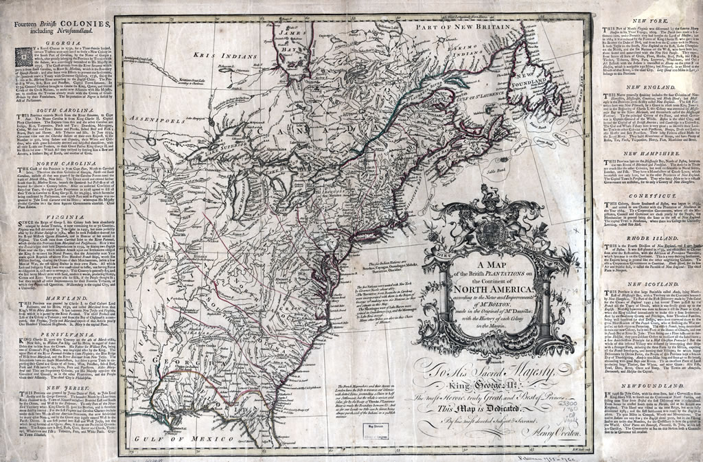
Image of a Map of the British Colonies between 1755 and 1760. Obtained from the Library of Congress and uploaded by User:Jacob F. Roecker, released to the Public Domain.
File history
Click on a date/time to view the file as it appeared at that time.
| Date/Time | Thumbnail | Dimensions | User | Comment | |
|---|---|---|---|---|---|
| current | 19:56, 11 March 2022 | | 1,024 × 673 (276 KB) | Maintenance script (talk | contribs) | == Summary == Importing file |
You cannot overwrite this file.
File usage
The following page uses this file: