San Francisco, California: Difference between revisions
imported>Anthony Argyriou (add →Transportation: and →Geography: and some pictures) |
imported>Anthony Argyriou (→Geography: ') |
||
| Line 8: | Line 8: | ||
San Francisco is at the tip of a peninsula formed by a ridge of the [[Coast Ranges]] of California. A gap in the ridge is below sea level , creating the [[Golden Gate]], which is the mouth of San Francisco Bay, and the drainage point for the entire Central Valley of California. The ridge has three main peaks within San Francisco, the Twin Peaks and Mount Davidson, near the geographic center of the city. The western half of the city is primarily sand dunes grading up towards the rocky peaks. Ocean Beach runs 4 miles along the Pacific coast. A significant part of the eastern shore of the city is land reclaimed from San Francisco Bay. | San Francisco is at the tip of a peninsula formed by a ridge of the [[Coast Ranges]] of California. A gap in the ridge is below sea level , creating the [[Golden Gate]], which is the mouth of San Francisco Bay, and the drainage point for the entire Central Valley of California. The ridge has three main peaks within San Francisco, the Twin Peaks and Mount Davidson, near the geographic center of the city. The western half of the city is primarily sand dunes grading up towards the rocky peaks. Ocean Beach runs 4 miles along the Pacific coast. A significant part of the eastern shore of the city is land reclaimed from San Francisco Bay. | ||
San Francisco has a variety of distinct neighborhoods, defined partly by physical geography and partly by patterns of settlement. The downtown area includes the '''Financial District'', which is bordered by '''North Beach''', '''Chinatown''', '''The Castro''', and '''South of Market (SOMA)'''. Other neighborhoods include '''The Mission''', centered along Mission Street, and including Mission San Francisco de Asís, '''Potrero Hill''', '''Noe Valley''', '''Hunters' Point''', the '''Western Addition''', the '''Marina District''', '''Haight-Ashbury''', the '''Richmond District''', the '''Sunset District''' (San Francisco's largest neighborhood), the '''Outer Mission''', and '''Ingleside'''. | San Francisco has a variety of distinct neighborhoods, defined partly by physical geography and partly by patterns of settlement. The downtown area includes the '''Financial District''', which is bordered by '''North Beach''', '''Chinatown''', '''The Castro''', and '''South of Market (SOMA)'''. Other neighborhoods include '''The Mission''', centered along Mission Street, and including Mission San Francisco de Asís, '''Potrero Hill''', '''Noe Valley''', '''Hunters' Point''', the '''Western Addition''', the '''Marina District''', '''Haight-Ashbury''', the '''Richmond District''', the '''Sunset District''' (San Francisco's largest neighborhood), the '''Outer Mission''', and '''Ingleside'''. | ||
==Economy== | ==Economy== | ||
Revision as of 13:01, 2 April 2008
The City and County of San Francisco is the fourth-largest city in California, and the center of the San Francisco Bay Area metropolitan area. It is the primary financial center of California, and was the largest city in California through the 19th Century and the earlier part of the 20th, until surpassed by Los Angeles.
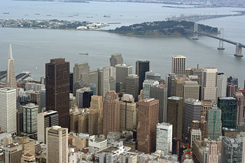
San Francisco is located at the northern tip of the San Francisco Peninsula, which separates the San Francisco Bay from the Pacific Ocean. Its land area is 46.7 square miles (121 km²). The population at the 2000 census was 776,733; the current estimate for 2007 is 764,976. The population has flucturated up and down from 679,000 to 777,000 since the end of World War II.
Geography
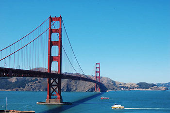
San Francisco is at the tip of a peninsula formed by a ridge of the Coast Ranges of California. A gap in the ridge is below sea level , creating the Golden Gate, which is the mouth of San Francisco Bay, and the drainage point for the entire Central Valley of California. The ridge has three main peaks within San Francisco, the Twin Peaks and Mount Davidson, near the geographic center of the city. The western half of the city is primarily sand dunes grading up towards the rocky peaks. Ocean Beach runs 4 miles along the Pacific coast. A significant part of the eastern shore of the city is land reclaimed from San Francisco Bay.
San Francisco has a variety of distinct neighborhoods, defined partly by physical geography and partly by patterns of settlement. The downtown area includes the Financial District, which is bordered by North Beach, Chinatown, The Castro, and South of Market (SOMA). Other neighborhoods include The Mission, centered along Mission Street, and including Mission San Francisco de Asís, Potrero Hill, Noe Valley, Hunters' Point, the Western Addition, the Marina District, Haight-Ashbury, the Richmond District, the Sunset District (San Francisco's largest neighborhood), the Outer Mission, and Ingleside.
Economy
San Francisco is home to a large number of financial companies, and is the home of the Pacific Stock Exchange. San Francisco is also home to many internet and software companies, though the main concentration is in Palo Alto, 30 miles to the south.
San Francisco was historically the primary port on the west coast of the United States, but has been surpassed by the Port of Los Angeles-Long Beach, and by the Port of Oakland, across the bay. Oakland was a pioneer in containerization, and much of San Francisco's traffic shifted to Oakland because of containerization and better transportation links in Oakland.
Due to the large number of very well-paid workers in the financial and internet industry, and restrictions on increasing density, housing in San Francisco is among the most expensive in the United States, second only to New York City. The entire region experienced a large run-up in prices in the 2000s, and while housing prices have declined in 2007 amd 2008, prices inside San Francisco proper have remained high.
Government
San Francisco is the only consolidated city and county in California. As a result, the city government has responsibility for municipal functions normally carried out at both the city and county level. The government is run by a Board of Supervisors, elected by district, and a Mayor, elected separately. San Francisco is the only county in California with a directly elected executive. Education is the responsibility of the San Francisco Unified School District, a separate entity.
San Francisco retains a separate police department and sheriff's department; the police chief is appointed by the Board of Supervisors, while the Sheriff is directly elected. The Sheriff is responsible for operating the city jail.
San Francisco is home to the 9th Circuit Court of Appeals, and the 12th District of the Federal Reserve.
History
San Francisco was founded in 1776 by Spanish explorers and missionaries. The initial founding was of a fort, and shortly thereafter, Mission San Francisco de Asís, one of the Franciscan missions established in California.
The discovery of gold in California in 1848 led to a gold rush, which drew people from all over the world to San Francisco. When word of the discovery of gold reached San Francisco, much of the population of about 1000 people left the city for the gold regions, but by 1850, San Francisco had 25,000 people, and continued to grow. As a result of the gold rush, banks were established in San Francisco, and the federal government opened a mint to coin the gold mined in California.
In 1906, an earthquake struck northern California. The earthquake is estimated to have been Richter magnitude 8.0. As a result of the earthquake, many buildings in San Francisco were destroyed, and a fire started which burned out of control for days, burning a significant portion of the city.
In the 1960s, San Francisco was one of the centers of the "counterculture", and was home to many rock and roll bands. The Haight-Ashbury neighborhood remains a magnet for the counterculture.
Transportation
San Francisco is connected by road to its neighbors via two freeways (US-101 and I-280) and two bridges, the Golden Gate Bridge and the Bay Bridge, and numerous streets and arterial roads across the land border with San Mateo County. There are also two publically-operated rail systems which run through San Francisco - the CalTrain system which runs conventional diesel-electric trains on standard track from downtown San Francisco to San Jose, and the Bay Area Rapid Transit (BART) system, which runs electric trains on special track on a line which runs from Millbrae and the San Francisco International Airport (SFO) through San Francisco, and via underwater tunnel to the East Bay.
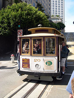
Public transit within San Francisco is operated by the Municipal Railway (Muni) which runs buses, light rail, and cable cars within the city. The light rail system runs underground in the Financial District, and under Twin Peaks to the West Portal neighborhood. The cable cars are limited to two lines, a remnant of a more extensive system. They are primarily a tourist attraction, and run from Market Street to the northern waterfront tourist areas.


