Angola: Difference between revisions
imported>Eddie Ortiz Nieves (added image) |
imported>Eddie Ortiz Nieves (→Geography: added image) |
||
| Line 7: | Line 7: | ||
==Geography== | ==Geography== | ||
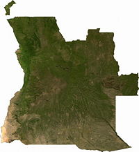
[[Image:Satellite Angola.jpg|thumb|right|200px|A satellite image of Angola. {{PD-image|The Map Library}}]] | |||
Angola has a total area of 481,321 mi² (1,246,700 km²). It is the 23rd largest country in the world.<ref>https://www.cia.gov/library/publications/the-world-factbook/rankorder/2147rank.html</ref> The country is bordered by [[Namibia]], [[Zambia]], the [[Democratic Republic of the Congo]], and the [[South Atlantic Ocean]]. The Angolan exclave of Cabinda borders the [[Republic of the Congo]] to the north.<ref>http://www.globalsecurity.org/military/world/war/cabinda.htm</ref> | Angola has a total area of 481,321 mi² (1,246,700 km²). It is the 23rd largest country in the world.<ref>https://www.cia.gov/library/publications/the-world-factbook/rankorder/2147rank.html</ref> The country is bordered by [[Namibia]], [[Zambia]], the [[Democratic Republic of the Congo]], and the [[South Atlantic Ocean]]. The Angolan exclave of Cabinda borders the [[Republic of the Congo]] to the north.<ref>http://www.globalsecurity.org/military/world/war/cabinda.htm</ref> | ||
Revision as of 16:39, 18 October 2007
Angola, officially the Republic of Angola (Portuguese: República de Angola; IPA: [ʁɛ'publikɐ dɨ ɐ̃'gɔlɐ]), is a country in southern Africa. It was a Portuguese colony until 1975. It is a member of the African Union. Its capital and largest city is Luanda, formerly known as Loanda. It uses West Africa Time. Its government is a republic and has a multi-party presidential regime.[1]
Provinces
Angola is divided into 18 provinces. These are Bengo, Benguela, Bié, Cabinda, Cuando Cubango, Cuanza Norte, Cuanza Sul, Cunene, Huambo, Huíla, Luanda, Lunda Norte, Lunda Sul, Malanje, Moxico, Namibe, Uíge, and Zaire.[2] Each province is subdivided into municipalities or municípios, also translated as "city councils". There are 163 total city councils in Angola.[3]
Geography

Angola has a total area of 481,321 mi² (1,246,700 km²). It is the 23rd largest country in the world.[4] The country is bordered by Namibia, Zambia, the Democratic Republic of the Congo, and the South Atlantic Ocean. The Angolan exclave of Cabinda borders the Republic of the Congo to the north.[5]
Demography
Angola has a total population of 12,127,071, as of the 2006 estimate.[6] 42% of the country's population is illiterate. Angola's ethnic groups include Ovimbundu (37% of the population), Kimbundu (25%), Bakongo (13%), mestico (mixed European and native African) (2%), European (1%), and others (22%).[1] The country's population holds different religious beliefs, including indigenous beliefs (47%), Catholic beliefs (38%), and Protestant beliefs (15%), according to a 1998 estimate.[6] The official language in the country is Portuguese, but other Bantu and African languages are also spoken. [6]
References
- ↑ 1.0 1.1 The CIA World Factbook (last updated October 4, 2007). Angola. Retreived on October 17, 2007.
- ↑ Gwillim Law. Administrative Divisions of Countries ("Statoids") (last updated on October 14, 2007). Provinces of Angola. Retreived on October 17, 2007.
- ↑ Gwillim Law. Administrative Divisions of Countries ("Statoids") (last updated on October 14, 2007). City Councils of Angola. Retreived on October 17, 2007.
- ↑ https://www.cia.gov/library/publications/the-world-factbook/rankorder/2147rank.html
- ↑ http://www.globalsecurity.org/military/world/war/cabinda.htm
- ↑ 6.0 6.1 6.2 http://www.nationbynation.com/Angola/Population.html