Battle of Beecher Island/Gallery: Difference between revisions
Jump to navigation
Jump to search

imported>Robert A. Estremo m (format) |
imported>Robert A. Estremo (add image) |
||
| (One intermediate revision by the same user not shown) | |||
| Line 1: | Line 1: | ||
{{subpages}} | {{subpages}} | ||
<gallery perrow= | <gallery perrow=3 widths=300px heights=250px> | ||
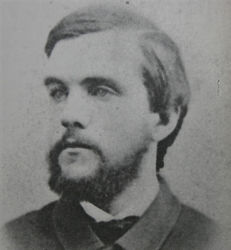
Image:Frederick H. Beecher .jpg|{{Frederick H. Beecher .jpg/credit}}<br />Lieutenant Frederick H. Beecher, United States Army. | Image:Frederick H. Beecher .jpg|{{Frederick H. Beecher .jpg/credit}}<br />Lieutenant Frederick H. Beecher, United States Army. | ||
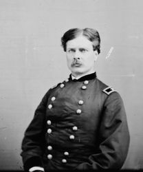
Image:James William Forsyth.jpg|{{James William Forsyth.jpg/credit}}<br />Brevet Brigadier General George A. Forsyth, United States Army. | Image:James William Forsyth.jpg|{{James William Forsyth.jpg/credit}}<br />Brevet Brigadier General George A. Forsyth, United States Army. | ||
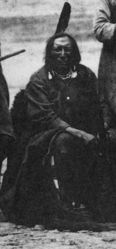
Image:Roman Nose at Fort Laramie in 1868.jpg|{{Roman Nose at Fort Laramie in 1868.jpg/credit}}<br />Northern Cheyenne warrior leader Roman Nose at Fort Laramie in 1868. | Image:Roman Nose at Fort Laramie in 1868.jpg|{{Roman Nose at Fort Laramie in 1868.jpg/credit}}<br />Northern Cheyenne warrior leader Roman Nose at Fort Laramie in 1868. | ||
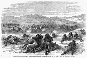
Image:The attack of fifty U.S. troops by several hundred Cheyenne, Sioux, and Arapaho warriors at the Battle of Beecher Island, in the dry bed of the Arikaree River in the Colorado Territory, 17 September 1868.jpg|{{The attack of fifty U.S. troops by several hundred Cheyenne, Sioux, and Arapaho warriors at the Battle of Beecher Island, in the dry bed of the Arikaree River in the Colorado Territory, 17 September 1868.jpg/credit}}<br />The attack of fifty U.S. troops by several hundred Cheyenne, Sioux, and Arapaho warriors at the Battle of Beecher Island, in the dry bed of the Arikaree River in the Colorado Territory, September 17, 1868. | |||
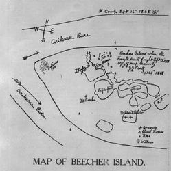
Image:Map of Beecher Island.jpg|{{Map of Beecher Island.jpg/credit}}<br />A hand-drawn map of the Beecher Island battle site prepared by a member of the rescue expedition. | Image:Map of Beecher Island.jpg|{{Map of Beecher Island.jpg/credit}}<br />A hand-drawn map of the Beecher Island battle site prepared by a member of the rescue expedition. | ||
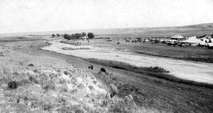
Image:Battle of Beecher Island Site 1917.jpg|{{Battle of Beecher Island Site 1917.jpg/credit}}<br />A view of tents, buildings, horses, and cattle at the annual scout reunion in 1917 to commemorate the Battle of Beecher Island near Wray, in Yuma County, Colorado. The Arickaree River flows near the camp. The Battle of Beecher Island monument is visible in the distance. | Image:Battle of Beecher Island Site 1917.jpg|{{Battle of Beecher Island Site 1917.jpg/credit}}<br />A view of tents, buildings, horses, and cattle at the annual scout reunion in 1917 to commemorate the Battle of Beecher Island near Wray, in Yuma County, Colorado. The Arickaree River flows near the camp. The Battle of Beecher Island monument is visible in the distance. | ||
</gallery> | </gallery> | ||
Latest revision as of 15:13, 19 May 2015
(PD) Photo: Earl Alonzo Brininstool
A view of tents, buildings, horses, and cattle at the annual scout reunion in 1917 to commemorate the Battle of Beecher Island near Wray, in Yuma County, Colorado. The Arickaree River flows near the camp. The Battle of Beecher Island monument is visible in the distance.
